
Jeffrey Lewis
Director of the East Asia Nonproliferation Program, The James Martin Center for Nonproliferation Studies
Director of the East Asia Nonproliferation Program, The James Martin Center for Nonproliferation Studies
How did commercial satellite imagery help us solve the Matiran mystery?
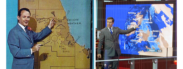
Today, if you look up, there is a pretty good chance that there is a satellite looking back at you. There are many satellites in orbit around the earth collecting images using all kinds of sensors, from what we might think of as “pictures” using light, to images built on remote sensing data like radar or temperature. We think nothing of watching the weather channel and seeing a satellite radar image of a hurricane barreling toward Florida – even though most people living in the United States today were alive when this technology was first broadcast on television in the early 1980s.
Soon, you will know a satellite is looking at you. Twenty four hours a day, seven days a week. Several firms are developing satellite constellations to provide continuous imaging of the entire earth. There are also companies that provide video from space, as well radar and temperature images. This is a pretty dramatic change to everything human beings do, from studying nuclear proliferation to meteorology – even if the weatherman still can’t get it quite right.
Today, there are dozens of satellites orbiting the earth taking pictures. These satellites belong to governments, which may use them to spy on neighbors, and private companies that sell the images to anyone. The best commercial satellite images are nearly as good as secret spy satellites – and much better than the spy satellites from not that long ago. Firms sell imagery with a resolution of 35 centimeters – that means each pixel in the image is only 35 centimeters wide. That is about the size of hubcap. Taken from a satellite that is nearly 700 km above the surface of the earth, the ability to see a hubcap is pretty amazing.
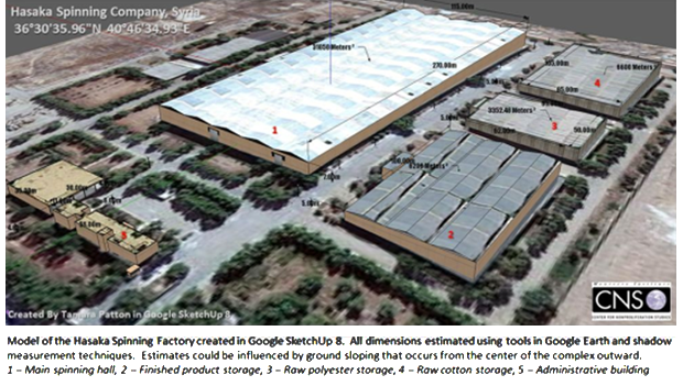
Commercial satellite images have completely changed how we approach nonproliferation problems. If someone tells you there is a secret nuclear facility in the Syrian desert, how do you know it is true? If someone shows you the facility, however, it is far easier to check it out. For example, in 2009 a former IAEA official told the Associated Press that Syria was constructing a gas centrifuge enrichment plant identical to one supplied to Libya by AQ Khan. This was a really big deal! A centrifuge plant in Syria could be used to enrich uranium to make a nuclear weapon. The AP bought an image of the site, as did independent analysts. Independent analysts, however, reached a different conclusion. The factory in the satellite picture matched photographs, available online, of a textile factory constructed by East Germany in the early 1990s. We were able to determine the name of the firm and prove that it was constructed in the early 1980s, long before contacts between AQ Khan and Syria. A German reporter ultimately interviewed the East German engineer who ran the project. The IAEA official was wrong. It was just a textile factory after all.
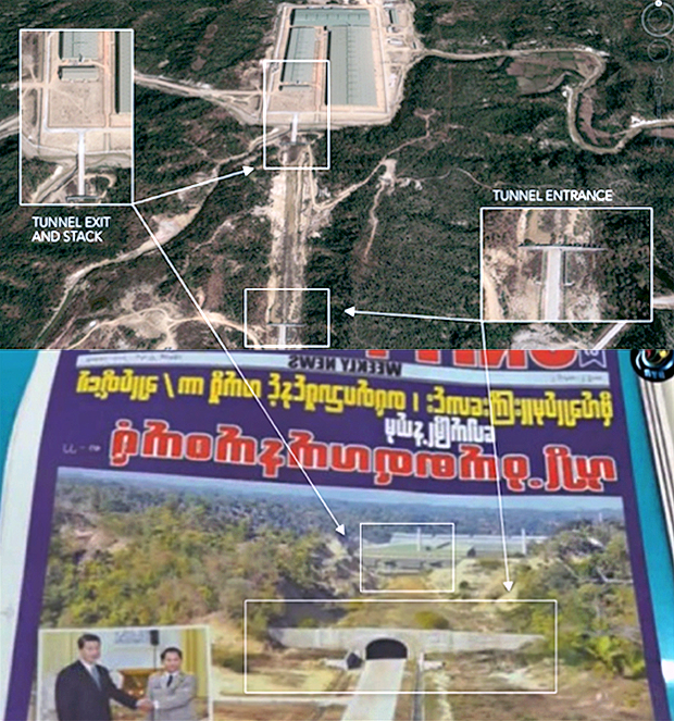
What if some villagers tell a reporter that the government has destroyed their village to build a massive arms factory? Again, seeing is believing. Burmese villagers told a local newsweekly that the Burmese government had taken their farms and razed their village in order to build an armaments factory. The Burmese government denied the story, arrested the journalists and seized physical copies of the newspaper. But we were able to locate the site and purchase satellite images of it. The villagers were telling the truth. The government had taken their farms, knocked down their houses and built a giant factory. This factory looked exactly like other factories built by the Directorate of Defense Industries, which the U.S. government has sanctioned for armaments cooperation with North Korean.
How did commercial satellite imagery help us solve the Matiran mystery?
Satellite images also played an important role in helping determine that the Matiran site was unlikely to be a secret centrifuge plant.
First, construction crews normally build large underground facilities using a method known as cut-and-cover. As the name suggests, one digs a large hole (“cut”), constructs the building inside the hole, then “covers” it with earth. This is how Iran constructed the underground centrifuge facility at Natanz. (It is also possible to tunnel horizontally into a mountain, as Iran did near Qom, but the Matiran site is flat.)
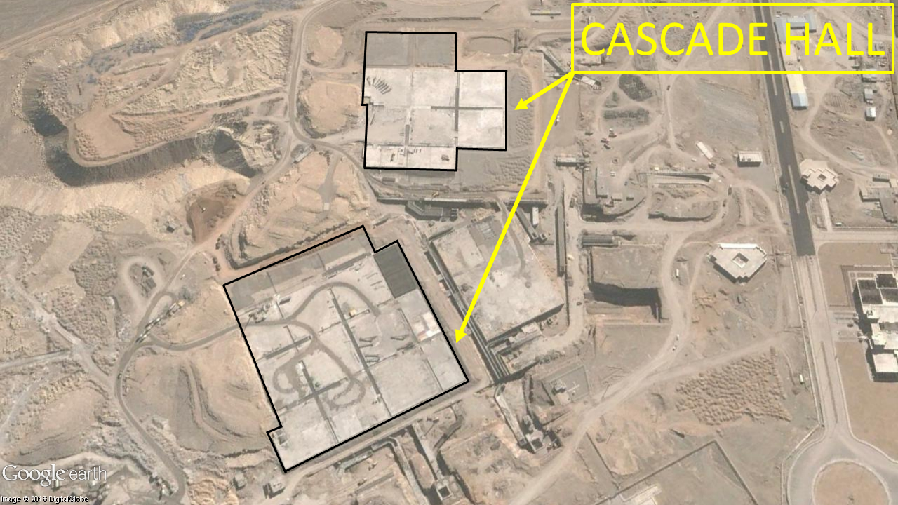
There are many satellite images of the Matiran site between 2004 and 2008 when the facility was allegedly constructed. None show any evidence of cut-and-cover construction. None show any construction to speak of.
Moreover, satellites images do not show either structures for ventilation or the electrical substation that one would expect to see at such a site. While these structures can be camouflaged, it hard to camouflage something while it is being built. While imagery analysis of Matiran did not conclusively disprove the allegations, it raised serious doubts about the reliability of the information.
Second, commercial satellite images allowed us to locate the warehouse where GMP manufactured and photographed the door. The windows in the full image of the door demonstrated conclusively that the door in the picture was not installed underground; they also enabled us to pinpoint with moderate confidence the building in which the door was located when GMP photographed it.

The metadata in the image was consistent with the assumption that the door was part of a larger set of images taken to advertise GMP’s products. We were able to geolocate the GMP warehouse visible in these images using commercial satellite images of the industrial part where the firm is located. With overhead images and ground-truth images, we were able to determine that the safe is probably sitting in that GMP building.
As a result, it is possible to say with high confidence that the image does not show a door either installed at the Matiran facility or waiting to be installed there.
Commercial satellite images alone, of course, were not enough to conduct this analysis. But it would have been nearly impossible without them. They were an essential component of determining the location of the site, modeling it and others, and ultimately concluding that many details in the original briefing were unlikely to be true.
Next read about Computer-aided Modeling, Metadata, Civil Data, and Social Media.
Your are currently on
Sign up for our newsletter to get the latest on nuclear and biological threats.
With the Center for Advanced Defense Studies, NTI demonstrates the viability of using publicly available information and machine learning to detect nuclear proliferation.
Progress on nuclear arms limitation and reduction is at risk, learn more and dismantle a nuclear weapon in augmented reality. (CNS)
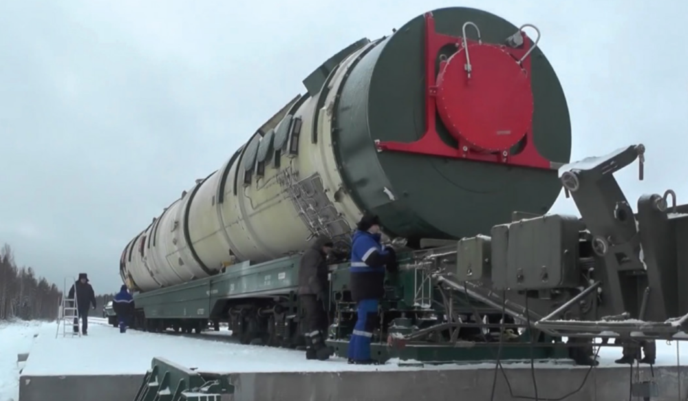
The first detailed, exclusively open-source assessment of the five new nuclear weapon systems announced by Russian President Vladimir Putin in 2018